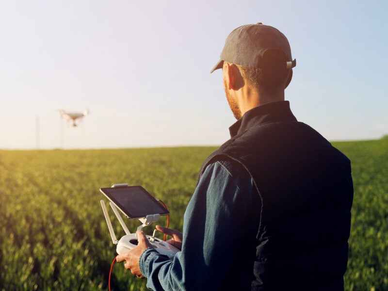
The integration of drone technology into agriculture has revolutionized the way farmers and agronomists manage crops and land resources. Agricultural mapping, a critical component of modern precision farming, benefits significantly from the capabilities of drones equipped with advanced imaging and sensor technology. By providing high-resolution aerial data, drones help optimize yield, improve resource management, and support sustainable farming practices.
Enhancing Crop Monitoring and Health Assessment
One of the most impactful applications of drone-based agricultural mapping is crop monitoring. Traditional methods, such as manual field inspections and satellite imagery, often fall short due to time constraints, cost, or resolution limitations. Drones bridge this gap by offering rapid, real-time assessments of crop health using multispectral, hyperspectral, and thermal imaging.
Multispectral imaging enables farmers to detect plant stress long before visible symptoms appear, identifying issues such as pest infestations, nutrient deficiencies, or water stress. By analyzing vegetation indices like the Normalized Difference Vegetation Index (NDVI), farmers can pinpoint problem areas and take proactive measures to prevent yield loss.
Precision Field Mapping and Land Analysis
Drones provide detailed field mapping, offering insights into soil conditions, topography, and land use. High-resolution RGB and multispectral imagery allow for the creation of Digital Elevation Models (DEM) and orthomosaic maps, which help farmers understand variations in soil moisture, erosion patterns, and drainage issues.
With accurate field data, farmers can make informed decisions on soil amendments, drainage improvements, and land use planning. This level of precision enables targeted interventions, reducing costs associated with fertilizers, irrigation, and labor.
Optimizing Irrigation Management
Water management is a critical challenge in agriculture, and drones play a vital role in optimizing irrigation systems. Thermal imaging sensors on drones detect temperature variations in crop canopies and soil, revealing areas of over- or under-irrigation.
By analyzing this data, farmers can fine-tune their irrigation schedules, ensuring efficient water use and reducing waste. This approach not only conserves water but also enhances crop quality and yield by preventing overwatering or drought stress.
Pest and Disease Detection
Drones equipped with advanced sensors assist in early pest and disease detection, which is crucial for timely intervention and crop protection. By capturing and analyzing aerial imagery, drones can identify abnormal crop patterns that may indicate the presence of pests, fungi, or bacterial infections.
This capability allows farmers to apply targeted treatments instead of blanket spraying, reducing pesticide use and minimizing environmental impact. Early detection also prevents the spread of infestations, saving farmers significant losses in crop yield.
Assessing Crop Damage and Insurance Claims
Extreme weather events, such as storms, droughts, and hail, can cause extensive damage to crops. Drones provide a fast and efficient way to assess damage across large agricultural areas, generating detailed reports that help farmers quantify losses for insurance claims.
Using aerial imagery, insurers can verify claims more accurately, reducing processing time and ensuring farmers receive fair compensation. This technology is particularly beneficial in large-scale farming operations where manual damage assessments are impractical.
Supporting Sustainable Agriculture and Regenerative Farming
Drones contribute to the sustainability of agricultural practices by enabling precision farming techniques that reduce waste, improve efficiency, and lower environmental impact. By providing actionable insights on soil health, crop stress, and irrigation needs, drones empower farmers to implement regenerative farming practices such as minimal tillage, cover cropping, and efficient resource use.
The ability to monitor biodiversity, soil degradation, and carbon sequestration also helps farmers align with global sustainability goals and climate-smart agricultural initiatives.
The Future of Agricultural Mapping with Drones
As drone technology advances, the potential applications in agricultural mapping will continue to expand. Emerging technologies, such as AI-driven analytics and machine learning, will further enhance the accuracy of crop health assessments, yield predictions, and automated data processing.
With improved battery life, connectivity, and sensor capabilities, drones will play an even more critical role in shaping the future of precision agriculture. By embracing drone technology, farmers can achieve greater productivity, resilience, and sustainability in their operations.
Conclusion
Drones have become indispensable tools in agricultural mapping, providing farmers with the data-driven insights needed to optimize crop production, manage resources efficiently, and promote sustainable farming practices. Whether it’s monitoring crop health, managing irrigation, or assessing damage, drones offer precision and efficiency that traditional methods cannot match. As the agricultural industry continues to evolve, drone technology will remain at the forefront of innovation, ensuring a more productive and environmentally responsible future for farming.